Oops! We couldn’t find any results...


Q1 Highlights: SheEO Venture, Aerial Mapping, and... one big challenge solved !
*** Hello Republic Investors! We shifted our updates to our Investor Email list in 2018, and it seems as if many of you are not receiving those updates. We certainly want to keep you in the loop with our progress, so please double check your spam filter and make sure you are able to receive emails from "Farm from a Box" bdecarli@farmfromabox.com. This is a copy of our latest update! Please let me know if you have any questions! ***
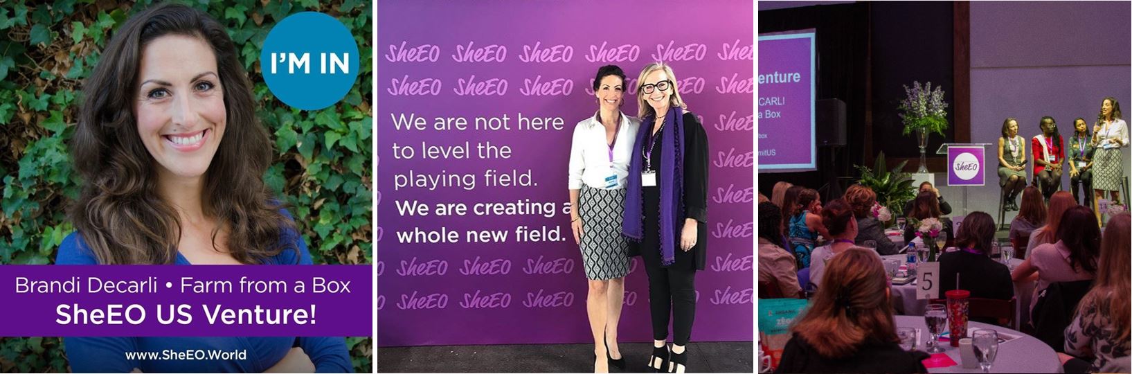
We were selected as a 2018 SheEo Venture!
We are thrilled to share that we have been selected as one this year’s SheEo U.S. Ventures!! SheEO is a radically redesigned ecosystem that supports, finances, and celebrates female innovators. It is a network of women investors that come together to collectively fund and support high-impact women-led companies.
SheEO Ventures are revenue-generating with export potential are creating a better world through their business model, product and service. In addition to receiving funding in the form of a non-dilutive 0% interest loan, being selected as a SheEO Venture give us access to a global network of women that work to support the growth of the company though business referrals, contacts and as buyers, which is already proving itself to be incredibly valuable!
Since returning from the SheEO Summit in Nashville, we have already been connected to new business contacts ranging from professional athletes and commercial farming groups, to the World Bank and global manufacturers!
DATA CHALLENGE SOLVED... and it was a big one.
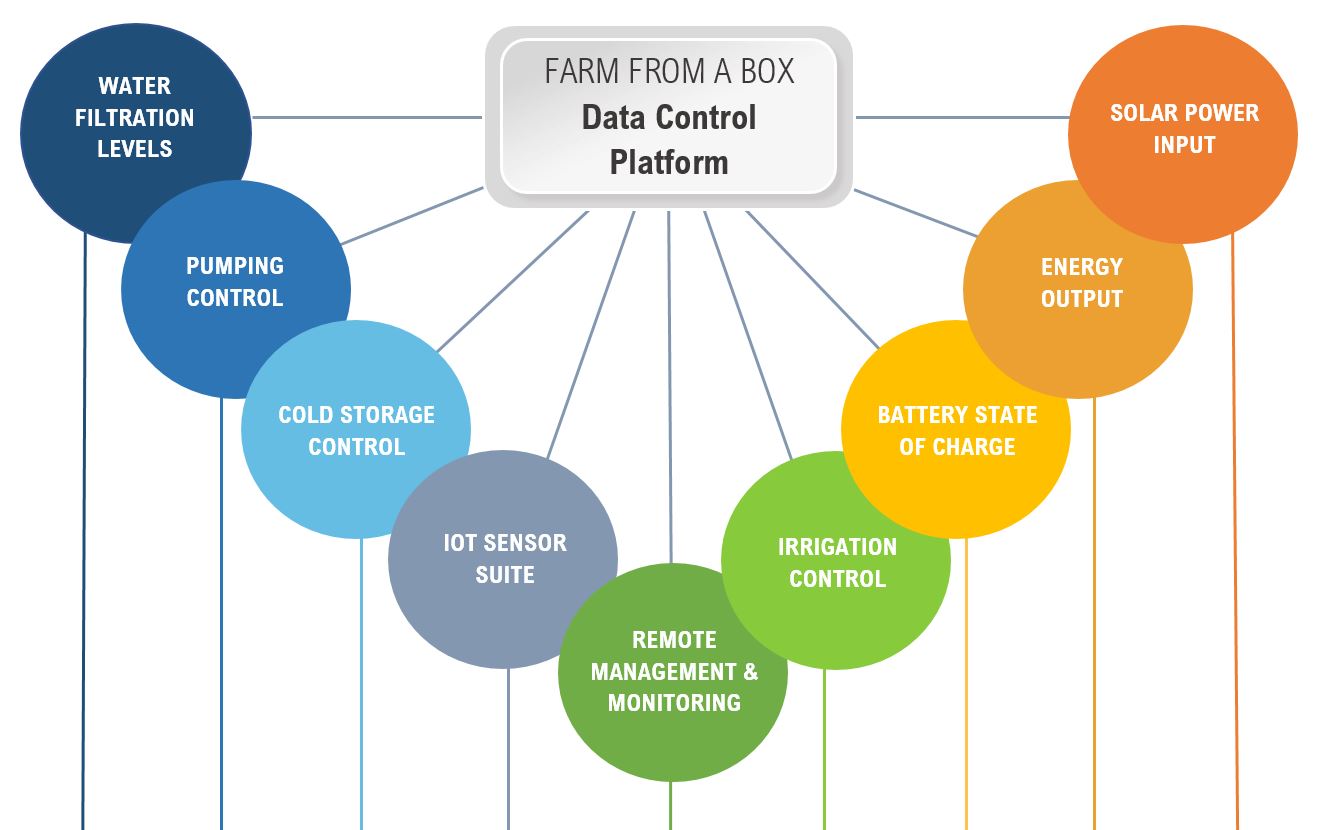
We all know that data is important, but the real value is in what you can do with it.
One of the first challenges we had in designing our system was to get each individual hardware component to work in concert with the other - from the solar power and water pump to the battery storage and the irrigation system. Once we achieved that, we started to build out our data control suite that would effectively marry all of our systems together into a single information platform that could provide greater levels of control and real-time data to make the farm easier to run, more efficient and more profitable.
Each component has its own data protocols and proprietary network systems that require you to login into their own individual website to retrieve that data. By using our Farm from a Box data platform, we were able to bring all of the information together into one dashboard!
Amazing, right? Well, here's where we ran into a WALL:
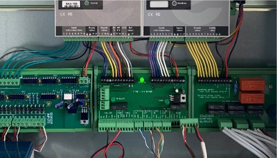
We found that the *communication would fail between the data controller and specifically, the invertor- which meant we were unable to integrate reliable data from our power system. [*That is an over simplification of the challenge that would likely make technologists cringe, but you get the point.]
So, we rolled up our sleeves and tried a variety of different of potential solutions- all of them resulting in irregular or incomplete data transfers, or complex work-arounds that left us feeling uneasy as to whether it would work reliably in the field.
And then, we took a different path: with the help of a new team, we completely rebuilt the entire data controller and its supporting code and... IT WORKS.
We are now able to get all of the data in a reliable, streamlined way.
Because of this challenge, we had to delay the release of the of the data platform and ultimately chose to push back the product launch until we were able to effectively track and monitor the complete system. We are now back on track, finalizing our front-facing data platform which will be launched with the product!
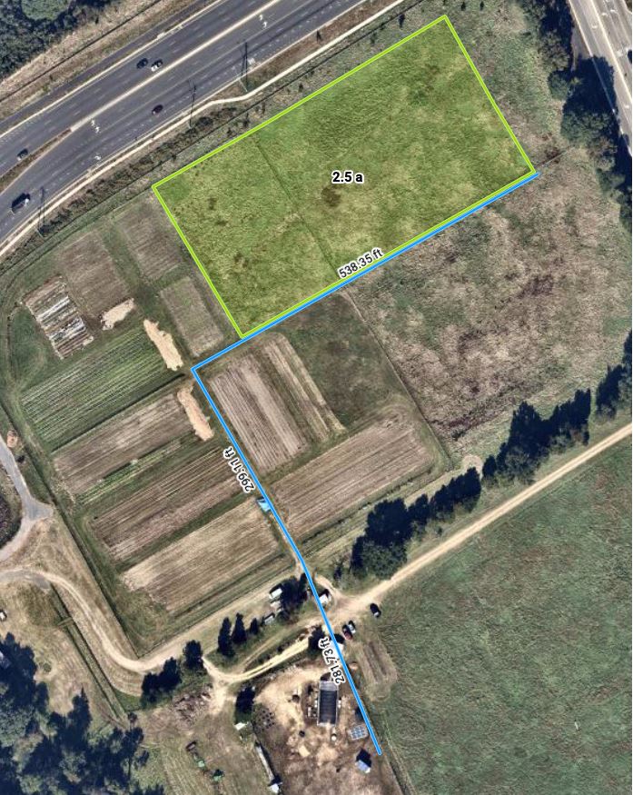
New High-Resolution Aerial Mapping and Location Data
For us to properly configure a unit to the local conditions, we have to map it out with as much on-the-ground information as we can. But how do we do that effectively on a large scale? We needed to have put a system in place that would allow us to quickly and accurately map the planned area of the farms remotely.
Our new aerial mapping and location data service allows us to do just that!
This technology enables us to:
- Precisely map the total acreage of the land
- Accurately measure the distance between the planned location of the unit and the fields so we can correctly design the irrigation scheme.
- Calculate an accurate power configuration for the water pump.
- Design the layout for sensors and valve positioning remotely.
- Provide our buyers with a clear picture of the farm plan.
- Communicate clear site access points for delivery and deployment.
- Stream all of the data from the cloud while reducing risk and costly site visits!
For example, the image below is of our veteran farm in Alexandria, Virginia. The green block shows the land that will be planted, while the blue line denotes the irrigation main line required by length for the entire field connecting to the pump. This system allows us to create estimates and plans with speed and accuracy, without having to travel to the site.... which means, we can streamline the configuration, plan with aerial precision, AND be operationally prepared to fulfill a higher number of orders, all while saving on deployment and travel costs!
BUT WAIT!... there's MORE!
In addition to helping us get a complete picture of the project area for more accurate design, configuration, and deployment- we are able to view each site over time so we can see the seasonal changes of the farm!
This allows us to not only better visualize the farm throughout the year, but we can also showcase the impact Farm from a Box has on the local area with a historical aerial view of each farm: whether the farm is on a school, within an urban area, or a rural commercial farm- we can literally see how sustainable local food production is being woven into the very tapestry of a community!
Click on the video below to see the before and after transformation of our West Sacramento IRC farm...
From an undeveloped vacant lot to an urban oasis of healthy food!
There is much more coming down the pipeline that we are excited to share with you!
Stay poised, we have big things in store!